




The Andes do not simply cross Peru; they shape the country’s climate, history, food, architecture and everyday rhythm. Looking at a Peruvian Andes map is the easiest way to understand why two places that seem close can feel completely different. A road may climb from a dry valley to a cold plateau in a few hours, while a trail can pass through cloud forest, high grasslands and snow-covered terrain in a single day.
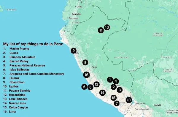
For travelers, the mountains can also be confusing at first. Famous names such as Cusco, Huaraz, Lake Titicaca, the Sacred Valley and Colca Canyon appear across a vast area, and the straight-line distance between them says little about the actual journey. Altitude, mountain passes, road conditions and seasonal weather matter just as much as kilometers. A well-read Peruvian Andes map therefore becomes more than a geographic reference: it is a practical tool for designing a realistic itinerary.
This guide explains the main Andean regions of Peru, the cities that work best as travel bases, the most important peaks and the attractions worth locating before you book. It also shows how to connect northern, central and southern Peru without turning the trip into a race. Whether your priority is archaeology, trekking, photography, living culture or panoramic train travel, the Peruvian Andes map helps place every experience in context.
Understanding the Andes Mountains in Peru
The Andes run along the western side of South America and form one of the world’s great mountain systems. In Peru, they separate the narrow Pacific coast from the Amazonian lowlands and create a complicated interior of parallel ranges, deep river valleys, high plateaus and elevated basins. This is why a Peruvian Andes map rarely looks simple: the mountains are not one continuous ridge but a network of cordilleras and inter-Andean corridors.
Peru is traditionally described through three broad natural regions: coast, highlands and rainforest. The highlands, or sierra, include much of the country’s Andean territory, but the eastern slopes also descend into cloud forest and the upper Amazon basin. Machu Picchu is a good example. It belongs to the Andean world culturally and geographically, yet its lush setting feels very different from the dry Altiplano near Puno or the glaciated Cordillera Blanca near Huaraz.
When reading a Peruvian Andes map, pay attention to four elements:
- Elevation, because sleeping at 3,800 meters is very different from visiting that altitude for a few hours.
- Mountain ranges, which determine where the major trekking and climbing areas are located.
- Valleys and plateaus, where many cities, farms and archaeological sites developed.
- Transport corridors, which often follow rivers, passes and long-established trade routes.
A standard road map is useful, but a relief map or Peru mountain map gives a more honest picture of travel. It reveals why flights are sometimes more practical than buses, why short drives can take half a day, and why acclimatization should be treated as part of the itinerary rather than as an inconvenience.
You might be interested in reading: Historical sites in Peru 2026
The Main Regions on a Peruvian Andes Map
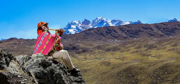
A practical way to organize the mountains is to divide them into northern, central and southern sectors. These divisions are not strict political borders, but they help travelers understand distances and choose a coherent route.
Northern Andes: Cajamarca, Chachapoyas and the Highland Valleys
The northern Andes are generally lower and greener than the most famous ranges farther south. Their landscapes include rolling agricultural hills, cloud forests, limestone formations and fertile valleys. Cajamarca is the best-known highland city in this zone, while Chachapoyas serves as a gateway to archaeological sites and waterfalls on the eastern side of the mountains.
On a Peruvian Andes map, the north is often overlooked because it lies far from the classic Lima–Cusco circuit. That relative isolation is part of its appeal. Cajamarca combines colonial streets, dairy farms, thermal baths and major Inca-era history. Farther east, the Chachapoyas region offers Kuélap, cliffside burial sites and the Gocta waterfall area. The journeys take time, but the atmosphere is usually quieter than in Peru’s busiest southern destinations.
The northern section suits travelers interested in archaeology beyond the Inca period, rural landscapes and less crowded routes. It can be combined with the coast around Trujillo or Chiclayo, although overland connections require careful scheduling. In this region, the Peruvian Andes map is especially helpful for comparing indirect roads with domestic flight options.
Central Andes: Cordillera Blanca, High Plateaus and Historic Cities
The central Andes include some of Peru’s most dramatic mountain scenery. The Cordillera Blanca rises in Áncash and contains Huascarán, the country’s highest summit, as well as turquoise glacial lakes and internationally known trekking routes. Huaraz is the essential base for this area.
Farther south and east, the Peruvian Andes map shows highland cities such as Huancayo and Ayacucho, connected by valleys, puna grasslands and mountain roads. The central highlands are culturally rich and geographically varied. They contain pre-Inca archaeological sites, traditional weaving communities, pastoral landscapes and some of the most demanding road journeys in the country.
This sector is ideal for serious hikers, mountaineers and travelers who want a deeper view of highland Peru. It is also useful for repeat visitors who have already seen Cusco and are ready to explore a different Andean corridor.
Southern Andes: Cusco, the Altiplano and the Volcanic South
The southern Andes contain Peru’s most famous attractions. Cusco and the Sacred Valley form the cultural center of the classic route, Machu Picchu lies on the humid eastern slope, Puno sits beside Lake Titicaca on the Altiplano, and Arequipa opens the way to volcanic landscapes and Colca Canyon.
This part of the Peruvian Andes map includes enormous changes in altitude and vegetation. The Sacred Valley is relatively sheltered and fertile, Cusco stands much higher, the route toward Puno crosses broad plains above 4,000 meters, and the descent toward Arequipa enters a drier volcanic environment. These contrasts make the south especially rewarding, but they also require sensible pacing.
First-time visitors often focus on this region because transport connections are well established and the concentration of landmarks is exceptional. Even so, trying to fit Cusco, Machu Picchu, Puno, Arequipa and Colca into one week usually creates more fatigue than enjoyment.
You might be interested in reading: 4 days in lima for food lovers: a culinary itinerary
Main Cities to Locate on the Peruvian Andes Map
The cities of the Andes are not merely overnight stops. Each one provides access to a different landscape and has its own historical character, food traditions and pace of life. Marking the following cities on a Peruvian Andes map makes route planning much easier.
Cusco: Cultural Capital and Gateway to the Sacred Valley
Cusco is the most important base in the southern Andes and the logical starting point for Machu Picchu, the Sacred Valley, Rainbow Mountain and several multi-day treks. The city stands at roughly 3,400 meters, so many travelers feel the altitude soon after arrival.
Its historic center brings together Inca stonework, colonial churches, plazas, markets and museums. However, Cusco should not be treated only as a transit point. Two or three unhurried days allow time to acclimatize while visiting Sacsayhuamán, Qorikancha, San Blas and local food markets.
On a Peruvian Andes map, Cusco appears close to many major attractions, but road and rail times vary considerably. The Sacred Valley lies lower than the city, making places such as Pisac, Urubamba and Ollantaytambo useful for gradual acclimatization. Travelers arriving directly from sea level often benefit from sleeping in the valley before spending several nights in Cusco.
Huaraz: Peru’s Trekking and Climbing Hub
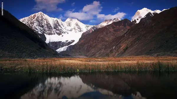
Huaraz lies in the Callejón de Huaylas, between the Cordillera Blanca and the Cordillera Negra. This position makes it one of South America’s outstanding mountain bases. Day trips reach Laguna 69, the Llanganuco lakes, Pastoruri Glacier and archaeological sites, while longer expeditions enter the Santa Cruz valley, the Huayhuash region and high climbing routes.
The city itself is practical rather than monumental. Its value comes from equipment services, mountain guides, transport connections and easy access to extraordinary scenery. A Peruvian Andes map centered on Huaraz quickly fills with valleys, trailheads, lakes and peaks, so it is worth choosing only a few objectives instead of collecting excursions.
Acclimatization is essential here. Huaraz is already above 3,000 meters, and many day trips climb well beyond 4,000 meters. A gentle first day and a progressive sequence of hikes usually produce a better experience.
Puno: the Altiplano and Lake Titicaca
Puno stands on the shore of Lake Titicaca at approximately 3,800 meters. The city is a base for boat trips to island communities and for exploring the cultural landscape of the Altiplano. It is also an important connection between Cusco, Arequipa and Bolivia.
The terrain around Puno looks broad and open, but the altitude is demanding. The Peruvian Andes map shows a vast plateau rather than sharp alpine relief, and that visual openness can make visitors underestimate the elevation. Nights are cold, sunlight is intense, and even a short uphill walk may feel surprisingly tiring during the first day.
The region is known for festivals, music, textiles and communities with long relationships to the lake. Visits should go beyond a quick photograph. Smaller islands, family-run stays and carefully selected cultural experiences can make the journey more meaningful.
Arequipa: Volcanic Landscapes and the Road to Colca
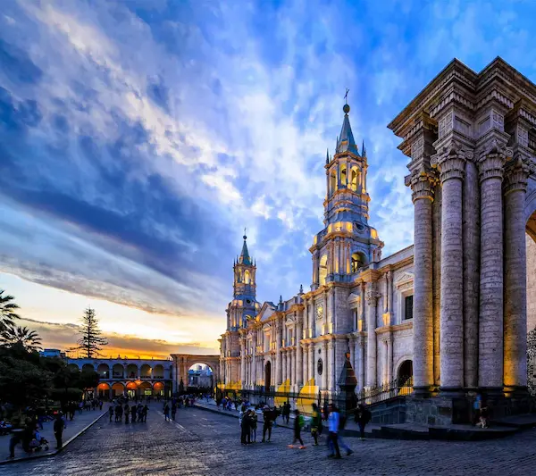
Arequipa sits lower than Cusco and Puno, at around 2,300 meters, beneath a skyline dominated by volcanoes. Its historic center, built largely with pale volcanic stone, gives the city a distinctive appearance. It is one of Peru’s best places for food, architecture and a slower urban stay.
Although Arequipa is sometimes described separately from the high Andes, it belongs on any useful Peruvian Andes map because it is the principal gateway to Colca Canyon, the Salinas and Aguada Blanca area, and high volcanic routes. The road to Colca crosses very high passes before descending toward Chivay, so travelers may reach elevations above 4,500 meters during the journey.
Arequipa works well after Puno because the itinerary gradually descends, but it can also serve as a gentle first stop before moving higher. Two days in the city and two or three days in Colca create a balanced visit.
Huancayo: Markets, Crafts and the Central Highlands
Huancayo lies in the Mantaro Valley and offers a more everyday view of Andean urban life. It is known for markets, crafts, nearby villages and agricultural landscapes. Unlike Cusco, it does not revolve primarily around international tourism.
For travelers using a Peruvian Andes map to build an alternative central route, Huancayo can connect with Lima and Ayacucho, although schedules and road conditions should be checked carefully. The region is valuable for people interested in local commerce, food production, weaving and the relationship between a highland city and its surrounding villages.
Ayacucho: Churches, Art and Living Traditions
Ayacucho combines colonial architecture with strong Indigenous artistic traditions. It is especially known for religious celebrations, retablos, ceramics and nearby archaeological sites. The city also provides access to landscapes that feel remote despite being connected by road and air to Lima.
On the Peruvian Andes map, Ayacucho occupies an important position between central and southern Peru. It can be added to a longer overland journey, but it deserves more than a rushed overnight stop. The surrounding region offers Wari heritage, traditional workshops and highland scenery with relatively few foreign visitors.
Cajamarca: a Northern Highland Alternative
Cajamarca is set among green hills and farmland in northern Peru. Its historic significance is closely associated with the encounter between the Inca ruler Atahualpa and the Spanish expedition led by Francisco Pizarro. The city also has thermal baths, churches, viewpoints and a relaxed regional character.
A Peruvian Andes map places Cajamarca far from the better-known southern circuit, which explains why it attracts fewer international visitors. It is best included in a northern itinerary with coastal archaeological destinations or as the beginning of a deeper journey toward Amazonas.
You might be interested in reading: 15 fun things to do in cusco for first-time travelers
Major Peaks and Mountain Ranges
The mountains shown on a Peruvian Andes map vary from glaciated summits to broad volcanic cones. Reading the Peruvian Andes map by range, rather than by political region alone, makes these mountain groups easier to understand. Some are technical climbing objectives; others are sacred landmarks, trekking companions or scenic viewpoints. Elevation alone does not determine difficulty, and travelers should distinguish between seeing a mountain, hiking near it and attempting a summit.
Huascarán and the Cordillera Blanca
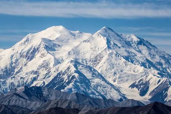
Huascarán is Peru’s highest mountain, reaching about 6,768 meters. It rises within Huascarán National Park in the Cordillera Blanca, a range famous for tropical glaciers, sharp summits and high-altitude lakes. The mountain has two principal summits and requires a serious, guided expedition with glacier and mountaineering experience.
For most visitors, the attraction is not climbing Huascarán itself but seeing the massif from the Callejón de Huaylas or exploring nearby valleys. The Peruvian Andes map around Huaraz also highlights Alpamayo, Artesonraju, Chopicalqui, Huandoy and numerous other peaks that define the region’s skyline.
Alpamayo: an Iconic Pyramid of Ice
Alpamayo is often recognized for its steep, elegant shape. Although lower than Huascarán, it is a technical climb and should never be confused with a standard trekking objective. The approach passes through beautiful valleys and forms part of longer routes in the northern Cordillera Blanca.
On a detailed Peruvian Andes map, Alpamayo appears amid a dense concentration of summits and glacial basins. Trekkers can appreciate the mountain from established circuits without attempting the face itself.
Yerupajá and the Cordillera Huayhuash
Yerupajá, at roughly 6,634 meters, is the highest mountain in the Cordillera Huayhuash and the second-highest summit in Peru. The range is compact, remote and visually dramatic, with turquoise lakes, steep passes and isolated communities.
The Huayhuash circuit is among Peru’s great multi-day treks. It normally requires careful logistics, good fitness, acclimatization and respect for local community arrangements. The Peruvian Andes map may make the circuit look close to Huaraz, but access roads and mountain conditions mean that it should be planned as a separate expedition.
Ausangate: Sacred Mountain of the Cusco Region
Ausangate rises southeast of Cusco and reaches more than 6,300 meters. It is an important apu, or sacred mountain, in local Andean belief. The surrounding circuit passes through high grasslands, glacial lakes, herding communities and remote passes.
Rainbow Mountain is located in the broader Ausangate area, which has increased visitor traffic. A Peruvian Andes map helps clarify that the short Rainbow Mountain excursion and the multi-day Ausangate trek are very different experiences. The first is a demanding day trip at extreme altitude; the second is a sustained high-mountain journey requiring preparation.
Salkantay: the Dramatic Route Toward Machu Picchu
Salkantay stands northwest of Cusco and is one of the most recognizable peaks near the classic routes to Machu Picchu. The Salkantay trek crosses a high pass before descending into warmer cloud forest. This rapid ecological transition is one of the route’s strongest attractions.
When comparing trails on a Peruvian Andes map, travelers should remember that the Salkantay route is not simply an alternative version of the Inca Trail. It has different scenery, camps, logistical systems and historical emphasis. Both routes can be excellent, but they suit different expectations.
Coropuna, Misti and the Volcanic South
The Arequipa region contains major volcanic peaks. Coropuna is the highest volcano in Peru, while Misti forms the classic backdrop to Arequipa. Chachani and Ampato are also prominent in the southern volcanic landscape.
These mountains appear broad and accessible from a distance, but high altitude, loose terrain, cold and exposure can make ascents serious. The Peruvian Andes map should be used only as a first reference. Current conditions, access rules and guide advice are more important when planning any climb.
You might be interested in reading: 5 best places to visit in Peru
Essential Attractions to Mark on the Map
The best-known Andean attractions are spread across several regions. Marking them before choosing flights and hotels prevents inefficient backtracking and helps build a route around geography rather than around a wish list.
Machu Picchu and the Cloud-Forest Edge
Machu Picchu stands at about 2,430 meters on the eastern slopes of the Andes, where mountain terrain meets the upper Amazon basin. Its setting explains the dense vegetation, steep ridges and frequent mist that distinguish it from the drier highlands around Cusco.
A Peruvian Andes map shows three main stages in the journey: Cusco, the Sacred Valley and the sanctuary area near Aguas Calientes. Travelers can arrive by train, combine rail with a trek, or follow one of several multi-day routes. Entrance systems and train arrangements should be reserved in advance, especially during popular travel months.
The site is best appreciated with enough time to observe its agricultural terraces, urban sectors, water channels and relationship to the surrounding mountains. Treating it as a quick photo stop misses much of its value.
The Sacred Valley
The Sacred Valley follows the Urubamba River between high mountain walls. Pisac, Ollantaytambo, Chinchero, Moray and the Maras salt pans are among its principal stops, although each has a different historical and geographical context.
On the Peruvian Andes map, the valley forms a natural corridor between Cusco and the train route to Machu Picchu. It is also lower than Cusco, so it can be a comfortable place to begin acclimatization. Staying in one or two towns rather than making repeated day trips from Cusco reduces driving time and creates a calmer experience.
Huascarán National Park and the Lakes of Áncash
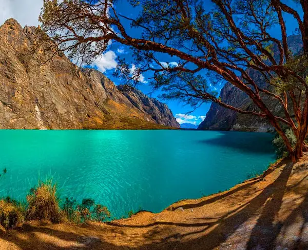
Huascarán National Park protects a vast high-mountain landscape in the Cordillera Blanca. Popular areas include the Llanganuco lakes, Laguna 69, Pastoruri Glacier and valleys used for trekking and climbing. Conditions vary by season, and some routes involve long days at elevations above 4,000 meters.
A Peruvian Andes map is especially useful here because attractions are distributed among different valleys and trailheads. Laguna 69, Pastoruri and Chavín de Huántar are not located along one simple road. Grouping excursions logically can save hours of transport and reduce physical strain.
Chavín de Huántar
Chavín de Huántar is one of Peru’s most important pre-Inca archaeological sites. Its ceremonial architecture, carved stone and internal galleries reveal the influence of a culture that developed long before the Inca Empire.
The route from Huaraz crosses high terrain and descends toward the eastern side of the range. Looking at the Peruvian Andes map before the trip helps explain why the journey is lengthy despite the site’s apparent proximity. The change in watershed is part of the experience and provides a wider understanding of how ancient religious centers connected different ecological zones.
Lake Titicaca and the Altiplano
Lake Titicaca is one of the defining features of the southern highlands. From Puno, visitors can explore island communities, archaeological sites and viewpoints across the Altiplano. The landscape is open, bright and often windy, with large temperature changes between day and night.
The Peruvian Andes map shows that the lake extends across the Peru–Bolivia border and forms part of a larger highland cultural region. Responsible visits should respect community schedules, local authority and the difference between genuine cultural exchange and staged entertainment.
Colca Canyon
Colca Canyon combines deep geological relief, agricultural terraces, villages, hot springs and Andean condor viewing areas. Chivay is the main service town, while smaller settlements provide access to viewpoints and trekking routes.
A Peruvian Andes map makes clear that Colca is not a minor detour from central Arequipa. The drive crosses a high reserve and requires significant time. A two- or three-day visit is generally more comfortable than a very long single-day excursion, especially for travelers still adapting to altitude.
Rainbow Mountain and the Red Valley
Vinicunca, widely known as Rainbow Mountain, became famous for its colored mineral bands. The standard excursion begins very early and reaches an elevation above 5,000 meters. The walking distance may appear manageable, but oxygen levels make the outing physically demanding.
Before adding it to a Peruvian Andes map itinerary, consider whether your schedule includes enough acclimatization. The nearby Red Valley can provide broader scenery, but access arrangements can change. Weather also affects visibility, trail conditions and the intensity of the colors.
You might be interested in reading: How to prepare for high altitude when visiting the Andes
How to Build a Realistic Route
A strong itinerary connects places that belong together geographically. The Peruvian Andes map should guide the order of travel, while altitude should guide the pace.
A Classic Southern Route
A balanced first journey might follow this sequence:
- Lima for arrival and rest.
- Sacred Valley for two or three nights.
- Machu Picchu for one or two days, depending on the transport plan.
- Cusco for three or four nights.
- Puno for two nights.
- Colca Canyon for two nights.
- Arequipa for two or three nights.
This route works well because the traveler reaches the Sacred Valley before sleeping in higher Cusco, then continues across the Altiplano and gradually descends toward Arequipa. The Peruvian Andes map also shows a logical southbound progression with limited backtracking.
Lima is not an Andean city, but it is the country’s main international gateway and a useful place to recover before or after a mountain journey. Travelers with extra time can compare lima tours focused on food, history or coastal neighborhoods, while those interested in evening entertainment may research nightclubs in Lima after the highland portion of the trip.
A Trekking-Focused Huaraz Route
For a mountain-centered journey, allow at least one week in and around Huaraz:
- Day 1: arrive and walk gently in the city.
- Day 2: easy acclimatization outing.
- Day 3: a moderate lake or valley excursion.
- Days 4–7: a multi-day trek or a sequence of demanding day hikes.
- Day 8: reserve day for weather, rest or transport.
The Peruvian Andes map around Huaraz contains more possibilities than most visitors can complete in one trip. A focused plan is safer and more satisfying than booking a different high-altitude excursion every day.
A Northern Andes Route
A northern itinerary can connect Cajamarca with coastal archaeological centers, or continue toward Chachapoyas. Because overland distances are substantial, use a Peruvian Andes map together with current transport schedules. A ten- to fourteen-day plan gives enough time for the major sites without making every day a transfer day.
Working With Local Travel Specialists
Complex itineraries involving permits, train tickets, remote trailheads or private transfers benefit from local coordination. A reputable Peru Tour Operator can help connect the information on a Peruvian Andes map with realistic driving times, current access rules and appropriate acclimatization. The most useful specialist is not the one who adds the greatest number of stops, but the one who explains what should be removed to protect the quality of the trip.
Best Time to Explore the Peruvian Andes
The Andean dry season generally runs from around May to September, bringing clearer skies and colder nights to many highland areas. This is the most popular period for trekking, climbing and visiting archaeological sites. July and August can be busy, particularly around Cusco and Machu Picchu.
The wetter season, roughly from November to March, brings greener landscapes, more cloud and a higher chance of rain. Travel remains possible in many places, but trails can be muddy and mountain views less predictable. Some trekking routes or services may be restricted during the rainiest period.
April and October often work as transitional months, although conditions vary by region and year. A seasonal layer added to a Peruvian Andes map can help distinguish trekking priorities from cultural visits. The Peruvian Andes map covers such a large territory that there is no single weather rule for every destination. Huaraz, Cusco, Puno and Arequipa can experience different conditions during the same week.
Travelers should also consider local festivals, agricultural cycles and school holidays. These events can enrich a journey but may affect accommodation and transport availability.
Altitude, Safety and Responsible Travel
Altitude is the most important practical issue for many visitors. Symptoms can include headache, fatigue, nausea, poor sleep and shortness of breath. Fitness does not guarantee immunity, and rushing directly from sea level into strenuous activity is a common mistake.
Use the Peruvian Andes map to identify not only the altitude of each city but also the highest point reached during day trips. A traveler sleeping in Cusco may climb above 5,000 meters on a Rainbow Mountain excursion. Someone based in Arequipa may cross a pass above 4,500 meters en route to Colca. The overnight elevation tells only part of the story.
Helpful habits include:
- Ascend gradually when the itinerary allows.
- Keep the first day light.
- Drink water regularly and eat simple meals.
- Limit alcohol during early acclimatization.
- Inform a guide or hotel staff if symptoms become severe or worsen.
- Descend and seek medical care when serious symptoms appear.
Mountain travel also requires respect for changing weather. A printed Peruvian Andes map is useful in remote areas, but it should complement rather than replace local guidance, offline navigation and current route information. Sun can be intense at altitude, while temperatures fall quickly after sunset. Carry layers, rain protection, sun protection and enough water even on apparently short outings.
Responsible travel is equally important. Stay on established paths, avoid leaving waste, ask permission before photographing people closely and choose experiences that compensate local communities fairly. The Peruvian Andes map is full of places that are homes, grazing areas and sacred landscapes, not empty recreational spaces.
Practical Map-Planning Checklist
Before confirming the trip, review the route with a final checklist:
- Mark every overnight city and write its approximate elevation.
- Mark the highest elevation reached on each excursion.
- Calculate road time, not only distance.
- Separate full travel days from sightseeing days.
- Add at least one flexible day to a trekking itinerary.
- Check whether attractions require timed tickets or advance reservations.
- Confirm seasonal trail, road and rail conditions.
- Avoid scheduling the most strenuous activity immediately after arrival.
A Peruvian Andes map becomes truly useful when it is combined with a calendar. Reviewing the Peruvian Andes map one final time before booking often exposes unrealistic same-day transfers. Geography tells you where places are; a day-by-day plan reveals whether the route is comfortable.
Conclusion
Peru’s mountains are easier to appreciate when they are seen as a connected landscape rather than as a list of famous stops. Cusco belongs to a network of valleys and sacred peaks. Huaraz sits between two great cordilleras. Puno forms part of the vast Altiplano, while Arequipa opens toward volcanoes, reserves and deep canyons. Each city makes sense because of the terrain around it.
That is the real value of a Peruvian Andes map. It helps travelers understand why altitude changes the pace, why a nearby attraction may require a long journey, and why the best route is rarely the one with the most pins. It also reveals how archaeology, agriculture, pilgrimage, trade and modern tourism have all adapted to the same demanding geography.
My advice is to choose one or two regions and explore them properly. Leave space for a market, a village walk, an unexpected viewpoint or a quiet afternoon after a high-altitude excursion. The Andes reward attention more than speed. With a carefully planned Peruvian Andes map, the journey becomes not only easier to organize, but also far richer once you are there.
